Van Life Savings Spots for Grey Nomads 2026 | Free Camping & Stopovers Guide
The complete directory of verified rest areas, free camping zones and overnight stops across Australia for senior grey nomads — organized by state, with GPS, facilities, safety notes and honest reviews written by travellers who actually stopped there.
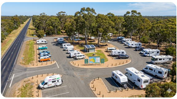
📅 Last updated: June 2026 | National Directory — All States and Territories | New locations added weekly
This directory exists because finding reliable, current information about where you can legally and safely sleep overnight in a campervan, motorhome or caravan across Australia is harder than it should be. Apps show locations that no longer exist. Council websites are outdated. Signage on arrival contradicts what you were told. And generic travel sites recommend spots without mentioning the broken toilets, the road noise, the lack of phone signal, or the fact that the site floods after rain and has been closed for six months. This guide is different. Every location listed here has been researched, cross-referenced against current council rules, and reviewed by actual grey nomads who stopped there — including what worked, what did not, and what you need to know before you arrive.
- Browse by state: Scroll to the state section you are planning to travel through
- Click through for full details: Every rest area link opens a complete guide with GPS, facilities, overnight rules, mobile coverage and safety notes
- Plan routes not just stops: Use the route planning section below to connect multiple stops into a safe, logical itinerary
- Check before you go: Rules and facilities change — always verify signage on arrival
- Bookmark this page: This directory is updated regularly with new locations and rule changes
- Combine with apps: Use this directory alongside Wikicamps and Campermate for the most complete picture
- Share updates: If you find a listing is out of date, let us know so we can update it for the next traveller
Directory Sections
- NSW South Coast Rest Areas & Free Camping
- NSW Outback & Inland Rest Areas
- NSW Riverina & Murray Corridor Rest Areas
- NSW Northern Rivers & New England Rest Areas
- Victoria Rest Areas & Murray Valley Stops
- Queensland Rest Areas & Inland Corridor
- Western Australia Rest Areas — Perth to Broome
- Northern Territory Rest Areas — Stuart Highway & Beyond
- How to Plan a Grey Nomad Route Using This Directory
- Safety Planning for Multi-State Travel
- Medical and Emergency Planning Across States
- Fuel, Water and Dump Point Planning
- Best Apps and Tools to Use With This Directory
- Free Camping Etiquette That Protects Access for Everyone
- Frequently Asked Questions
- Start Planning Your Trip
NSW South Coast Rest Areas & Free Camping
The NSW South Coast from Sydney to the Victorian border is one of the most travelled grey nomad routes in Australia — and for good reason. The coast is green, the climate is temperate most of the year, towns are frequent, medical facilities are accessible, and rest areas are well-maintained. This section covers verified overnight stops from Wollongong south through the Sapphire Coast to Eden.
Illawarra and Shoalhaven Coast
- Wollongong Rest Areas — Full Guide
- Shellharbour Rest Area — Full Guide
- Kiama Rest Areas — Full Guide
- Nowra Rest Areas — Full Guide
- Jervis Bay Rest Areas — Full Guide
- Ulladulla Rest Areas — Full Guide
Eurobodalla and Sapphire Coast
- Batemans Bay Rest Areas — Full Guide
- Moruya Rest Area — Full Guide
- Narooma Rest Areas — Full Guide
- Bermagui Rest Area — Full Guide
- Bega Rest Areas — Full Guide
- Merimbula Rest Areas — Full Guide
- Pambula Rest Areas — Full Guide
- Eden Rest Areas — Full Guide
NSW Outback & Inland Rest Areas
Outback and inland NSW — from the Blue Mountains west to Broken Hill, north to Bourke and across the central west plateau — demands different planning than the coast. Distances between towns are longer, fuel and water are not always available when expected, mobile coverage is patchy, and summer heat can be dangerous for seniors. The rest areas in this region are basic but essential, and knowing where they are before you leave is non-negotiable for safe outback travel.
Blue Mountains and Central West Gateway
- Sleepy Hollow Rest Area (Southbound) — Full Guide
- Marrangaroo Tunnel Hill Rest Area — Full Guide
- Robin Hill Rest Area — Full Guide
- Meadow Glen Rest Area — Full Guide
- Pearsons Lookout Rest Area — Full Guide
- Lidsdale State Forest Rest Area — Full Guide
Broken Hill and Far West Corridor
- Broken Hill Rest Area — Full Guide
- Broken Hill South Rest Area — Full Guide
- East of Wilcannia Rest Area — Full Guide
- 41 Mile Bore Rest Area — Full Guide
- Netallie Hill Rest Area — Full Guide
- Marr Creek Rest Area — Full Guide
Bourke and Northern Outback
- South of Bourke Rest Area — Full Guide
- Attack Creek Rest Area — Full Guide
- Belah Hill Rest Area — Full Guide
Central West and Parkes Region
- Square Bush Rest Area — Full Guide
- Panai Avenue Rest Area — Full Guide
- King West Rest Area — Full Guide
- Limestone Creek Rest Area — Full Guide
- Escort Rock Rest Area — Full Guide
NSW Riverina & Murray Corridor Rest Areas
The Riverina and southern NSW corridor along the Hume and Olympic Highways connects Sydney to Melbourne through productive agricultural country, historic river towns and the Murray River valley. Rest areas in this region are well-spaced, facilities are reasonable, and the terrain is flat and easy for towing. This is one of the most straightforward grey nomad routes in Australia.
Riverina and Murrumbidgee Corridor
- Jerilderie Rest Area — Full Guide
- Finley Rest Area — Full Guide
- Berrigan Rest Area — Full Guide
- Tocumwal Rest Area — Full Guide
Snowy Mountains Foothills
Hume Highway Corridor
- Gundagai Rest Area — Full Guide
- Tarcutta Rest Area — Full Guide
- Holbrook Rest Area — Full Guide
- Albury Rest Area — Full Guide
NSW Northern Rivers & New England Rest Areas
Northern NSW from the coast inland through New England offers green rolling hills, excellent climate most of the year, and a good network of rest areas along the Pacific Highway and New England Highway corridors. This region is popular with grey nomads heading north to Queensland or returning south.
Pacific Highway and Northern Coast
- Grafton Rest Area — Full Guide
- Grafton River Road Rest Area — Full Guide
- Pine Brush Rest Area — Full Guide
New England and Inland North
Victoria Rest Areas & Murray Valley Stops
Victoria has a more restrictive approach to free camping than NSW or Queensland, but the Murray Valley corridor and Hume Highway route still offer a reasonable network of rest areas for grey nomads travelling between Sydney and Melbourne or exploring the Riverina and Murray regions.
Victorian Murray Valley
- Shepparton Rest Areas — Full Guide
- Euroa Rest Area — Full Guide
- Seymour Rest Area — Full Guide
- Cobram Rest Area — Full Guide
- Broadford Rest Area — Full Guide
Queensland Rest Areas & Inland Corridor
Queensland offers some of the best free camping and rest area access in Australia, particularly in regional and inland areas. The state actively supports grey nomad travel with well-maintained rest areas, reasonable overnight rules, and a self-containment framework that rewards properly equipped vehicles. This section covers the inland Queensland corridor from the NSW border north and west.
Queensland Rest Areas — Statewide Overview
Western Australia Rest Areas — Perth to Broome
Western Australia has some of the longest distances between towns, the most remote rest areas, and some of the best free camping access in Australia. The northern corridor from Perth to Broome via the Brand Highway, North West Coastal Highway and Great Northern Highway is a classic grey nomad route — but it demands careful planning, conservative fuel and water management, and realistic expectations about facilities and mobile coverage.
Perth to Geraldton Corridor
Geraldton to Carnarvon
- Nerren Nerren Rest Area — Full Guide
- Coalmine Beach Rest Area — Full Guide
- Lyndon River Rest Area — Full Guide
Carnarvon to Karratha
Karratha to Broome
Southwest WA
Northern Territory Rest Areas — Stuart Highway & Beyond
The Northern Territory and the Stuart Highway from Darwin to the South Australian border is one of the iconic Australian road trips. Rest areas are basic, distances are long, heat is extreme in summer, and wet season (November to April) can close roads and make travel dangerous. But for grey nomads who plan properly and travel in the dry season (May to October), the Territory offers unforgettable landscape, Indigenous culture, and genuine outback remoteness.
Darwin to Katherine Region
- Adelaide River Rest Area — Full Guide
- King River Rest Area — Full Guide
- Limestone Creek Rest Area — Full Guide
Katherine to Tennant Creek
Tennant Creek to Alice Springs
How to Plan a Grey Nomad Route Using This Directory
This directory is not just a link list — it is a route planning tool. Here is how to use it effectively to plan a safe, logical grey nomad itinerary across one or multiple states.
Step 1: Choose Your Route Corridor First
Start with the broad route you want to travel — Sydney to Melbourne, Brisbane to Cairns, Perth to Broome, the full lap around Australia. Do not start with individual rest areas. Start with the corridor and work backward to find the stops that fit.
Step 2: Identify Your Overnight Stops
Browse the relevant state section in this directory and open the guides for rest areas along your chosen corridor. Note the distance between each stop, the facilities available, and any restrictions (time limits, no caravans, self-contained only). Plan overnight stops no more than 300 to 400 kilometres apart — less in remote areas or if you are towing a large van.
Step 3: Mark Fuel, Water and Dump Point Stops
Use the rest area guides to identify which towns have fuel, potable water and dump points. Mark these on your route plan. In coastal areas, these services are frequent. In outback areas, gaps can be significant — plan conservatively and never run fuel or water close.
Step 4: Note Medical Facilities Along Your Route
Each rest area guide in this directory includes the distance to the nearest hospital. Use this information to understand how far you are from medical help at every stage of your journey. For seniors managing ongoing health conditions, this is not optional planning — it is essential.
Step 5: Build in Buffer Days
Do not plan every day as a driving day. Build rest days into your itinerary — stay two nights at a caravan park, spend a day exploring a town, or simply take a break from driving. Grey nomad travel is not a race. The travellers who enjoy it most are the ones who plan buffer time.
Step 6: Have Backup Options
For every planned overnight stop, know the nearest caravan park as a backup. Rest areas can be full, closed for maintenance, or unsuitable when you arrive. Having a backup booked or identified in advance removes stress and keeps you safe.
Safety Planning for Multi-State Travel
Travelling across multiple states in a campervan, motorhome or caravan is safe when planned properly — but it introduces risks that do not exist on a weekend coastal trip. Distance from help, limited mobile coverage, extreme weather and unfamiliar roads all demand more careful preparation.
Personal Safety on the Road
- Let someone at home know your planned route and check in daily — this simple habit is your safety net when things go wrong in remote areas
- Carry a Personal Locator Beacon (PLB) registered with AMSA for areas with no mobile coverage — it can save your life when nothing else works
- Lock your vehicle overnight even at rest areas that feel remote and safe — security is a habit, not a reaction to fear
- Park facing the exit at every overnight stop so you can leave quickly if needed without reversing or turning in the dark
- Trust your instincts — if a rest area feels wrong when you arrive, move on to the next option even if it adds time or distance to your day
Vehicle and Trip Safety
- Check your vehicle before long remote stretches — tyre pressure, oil, coolant, brake fluid, and lights all matter more when the nearest mechanic is 200 kilometres away
- Carry a spare tyre in good condition and know how to change it — or carry NRMA, RACV or equivalent roadside assistance that covers remote areas
- Never drive fatigued — rest areas exist to prevent fatigue-related crashes, not just to provide overnight accommodation
- Wildlife strikes are a serious risk at dawn and dusk across most of Australia — reduce speed during these periods and watch for movement at the roadside
- Download offline maps and rest area information before leaving mobile coverage — do not rely on live data in remote areas
Medical and Emergency Planning Across States
For senior grey nomads — particularly those managing diabetes, blood pressure, cardiovascular conditions or using CPAP machines — medical planning is not optional. It is the difference between confident travel and constant worry about what happens if something goes wrong far from home.
| Emergency Service | Contact | When to Use | Coverage |
|---|---|---|---|
| Emergency Services | 000 | Any life-threatening emergency — police, ambulance, fire | Works from mobile even with weak signal that appears unusable for normal calls |
| Healthdirect Nurse-on-Call | 1800 022 222 | 24/7 health advice when unsure if emergency care is needed | National service — works from any phone with coverage |
| Royal Flying Doctor Service | 1300 669 569 | Serious medical events in remote areas more than 90 minutes from hospital | Operates across all of outback and remote Australia |
| Poisons Information Centre | 13 11 26 | Medication interactions, accidental ingestion, poisoning queries | National service — 24/7 |
What to Carry for Medical Planning
- A written medical summary including your conditions, all medications with dosages, known allergies, and your GP’s contact details — keep it accessible, not locked inside the van
- Sufficient medications for your entire trip plus a two-week buffer — do not rely on finding a pharmacy in a remote town
- A well-stocked first aid kit including bandages, antiseptic, pain relief, and any condition-specific supplies you need
- An insulated medication cooler or 12V fridge if you carry heat-sensitive medications like insulin — van temperatures in summer can exceed 50°C and destroy many medications
- Emergency contact cards in your wallet with ICE (In Case of Emergency) details including next of kin and medical conditions
Fuel, Water and Dump Point Planning
Running out of fuel, water or capacity to store waste are the three most common avoidable crises that grey nomads face on long-distance travel. All three are preventable with conservative planning and the habit of topping up whenever you have the opportunity rather than waiting until you desperately need to.
Fuel Planning
Use Fuel Map Australia or the individual rest area guides in this directory to identify every fuel station along your route. Note opening hours — many outback service stations close by 6pm and some operate reduced weekend hours or are closed Sundays. Plan to refuel whenever your tank drops to half, not quarter. Towing a caravan or driving a large motorhome increases fuel consumption by 30 to 50 percent compared to solo driving. Headwinds increase consumption further. Always carry more range than your planned route requires.
Water Planning
Carry a minimum of 20 litres of potable water per person at all times. More in summer. More in outback areas. Refill at every opportunity — caravan parks, town water taps, service stations that offer potable water. Never assume a rest area has potable water unless it is clearly signed. Many rest area taps are bore water, tank water or non-potable supply for facility cleaning only. Treat all unmarked water as non-potable and carry your own.
Dump Point Planning
Dump points are concentrated in towns at caravan parks, council facilities and some service stations. They rarely exist at rest areas. Use apps like Campermate or Wikicamps to locate dump points along your route and plan stops around towns with known facilities. Never dump grey water on the ground, into roadside drains or near rest areas — it is illegal, environmentally damaging, and the fastest way to get a rest area closed for everyone who follows you.
Best Apps and Tools to Use With This Directory
This directory is most effective when used alongside other planning tools and apps. Here are the apps and resources that work best with this directory to create a complete picture of where you can stop, what facilities exist, and what current travellers are reporting.
| App / Tool | What It Does | How to Use It With This Directory |
|---|---|---|
| Wikicamps Australia | Shows rest areas, free camps, caravan parks, dump points, user reviews | Cross-reference rest areas in this directory with Wikicamps user reviews to confirm current conditions before you arrive |
| Campermate | Free app showing camps, facilities, fuel, water — works offline | Use for route planning and offline access when you lose mobile coverage — download maps before leaving towns |
| Fuel Map Australia | Shows service stations, opening hours, and fuel prices | Essential for outback travel — identify every fuel stop along your route and note opening hours before you leave |
| Telstra Coverage Map | Shows mobile coverage by carrier across Australia | Use to understand where you will lose signal and plan offline map downloads and emergency communication accordingly |
| Bureau of Meteorology (BOM) | Weather forecasts, warnings, fire danger, road closures | Check daily in remote areas — weather changes can close roads, create dust storms or make travel dangerous at short notice |
| RV Trip Wizard | Route planning tool designed for RV and caravan travel | Use to map multi-day routes connecting rest areas from this directory with fuel, dump and medical facility planning |
Free Camping Etiquette That Protects Access for Everyone
Every rest area and free camping spot in this directory exists because councils, road authorities and land managers permit it — and that permission can be revoked. Free camping access across Australia is shrinking every year as sites are closed due to persistent misuse. Rubbish dumping, illegal grey water discharge, overstaying limits and permanent-style camping setups are the primary reasons sites get shut down. Your behaviour at every stop directly affects whether access remains open for the grey nomad community.
Rules That Protect Access
- Leave no trace: Take all rubbish with you. If the bin is full, carry rubbish to the next town — never leave it on the ground or beside overflowing bins
- No grey water dumping: Never drain grey water onto the ground, into drains or near rest areas. Use a sealed tank and dispose of it at proper dump points
- Respect time limits: If a rest area permits 24 hours, stay 24 hours maximum. Overstaying is one of the fastest triggers for new restrictions
- Keep setup minimal: Rest areas are for overnight vehicle stays, not for setting up permanent camps with awnings, annexes, outdoor kitchens and washing lines
- Generator use: If you must use a generator, run it during daylight hours only and for essential charging — not for entertainment or convenience late at night
- No open fires: Fires are prohibited at most rest areas even when not under fire ban. Use a gas cooker for meals
Frequently Asked Questions
How often is this directory updated?
This directory is reviewed and updated regularly as new rest areas are added, existing sites change their rules, or facilities are upgraded or closed. Individual rest area guides linked from this directory are updated when we receive reports from travellers or when we verify changes through council websites and apps like Wikicamps. That said, conditions can change faster than any website can track — always verify signage and rules on arrival.
Can I trust the GPS coordinates in this directory?
The GPS coordinates provided in each rest area guide are sourced from publicly available data, verified against multiple sources where possible, and cross-referenced with user reports. They are provided as planning guidance to help you locate rest areas before arrival. Always confirm the exact location on arrival using signage, visual landmarks and your own navigation system. GPS accuracy can vary, and coordinates can be slightly offset from the actual pull-off or parking area.
Why are some states better covered than others?
This directory reflects the rest areas and free camping spots that have been researched, verified and written up so far. NSW, Queensland, Western Australia and Northern Territory have the most comprehensive coverage because these states have the most active grey nomad travel and the most documented rest areas. Victoria, South Australia and Tasmania coverage is growing but currently more limited. New guides are added regularly.
What if a rest area I visit does not match the guide?
Rest area facilities, rules and conditions change without public notice. Toilets get closed for maintenance, water taps are disconnected, councils change overnight rules, and road authorities update signage. If you arrive at a rest area and find it does not match the guide in this directory, trust what you see on arrival over what any website says — including this one. On-site signage always takes legal precedence.
Can I submit a rest area to be added to this directory?
Yes. If you have stopped at a rest area in Australia that is not currently listed in this directory and you believe it would be valuable for other grey nomads, you can suggest it for inclusion. Provide the location name, state, approximate GPS coordinates, facilities present, and any relevant notes about overnight rules or conditions. Suggestions are reviewed before being added to ensure accuracy and relevance.
Is this directory only for caravans and motorhomes?
No. This directory covers rest areas and free camping spots suitable for campervans, motorhomes, caravans, and in some cases, rooftop-tent-equipped 4WDs. Each individual rest area guide notes whether the site is suitable for large rigs, whether access is tight, and whether caravans are specifically restricted. Many rest areas accommodate all vehicle types — some are better suited to smaller campervans.
Do all these rest areas allow overnight stays?
No. Some rest areas in this directory are signed for short fatigue breaks only and do not permit overnight stays. Each individual guide states clearly whether overnight stays are permitted, restricted or prohibited based on current signage and council rules. Always check the signage at the specific rest area on arrival — that is what determines legality, not what this or any other website says.
Can I use this directory offline?
This directory is a web page and requires internet access to view. However, you can save individual rest area guide pages as PDFs or bookmark them in your browser for offline reference. For true offline use, download apps like Wikicamps or Campermate which allow full offline map and campsite access once downloaded. Use this directory for planning before you leave, then rely on offline apps when you lose mobile coverage in remote areas.
Why do some links go to posts that are marked as lost or not ranking?
Some rest area posts in this directory are currently under review, being rewritten, or have temporarily lost search ranking due to algorithm changes or content updates. These posts are still published and accessible via direct link — they simply are not ranking well in Google search results at present. Posts marked as lost or zero ranking are being prioritized for rewrites and updates to restore their search visibility.
Start Planning Your Trip
This directory exists to make grey nomad trip planning simpler, safer and more reliable. You now have access to over 200 verified rest areas and free camping spots across Australia, organized by state and region, with direct links to full guides covering GPS, facilities, overnight rules, safety and medical distance for every location. The next step is to use this directory to plan your route.
Start with the state or region you plan to travel through. Browse the rest areas listed in that section. Open the guides for stops that fit your route. Note the facilities, distances and any restrictions. Cross-reference with apps like Wikicamps for recent user reviews. Map your fuel, water and dump point stops. Identify the nearest hospital at every stage. Build in buffer days. Have backup options. And plan conservatively — especially in outback and remote areas where help is far away and conditions can change quickly.
Free camping and rest areas fill fast during school holidays and peak grey nomad season. If your preferred site is full or unsuitable, search caravan parks and local accommodation below to keep your trip on track.
Accommodation search powered by Expedia. Booking through this search supports this website at no extra cost to you. As an affiliate, I earn from qualifying purchases at no extra cost to you.

As an affiliate, I earn from qualifying purchases at no extra cost to you.
Exclusive Offer: Get 5% OFF all StarterStopper immobiliser products with promo code: RTV5
Visit StarterStopper.com to see our data-backed security solutions
As an affiliate, I earn from qualifying purchases at no extra cost to you.